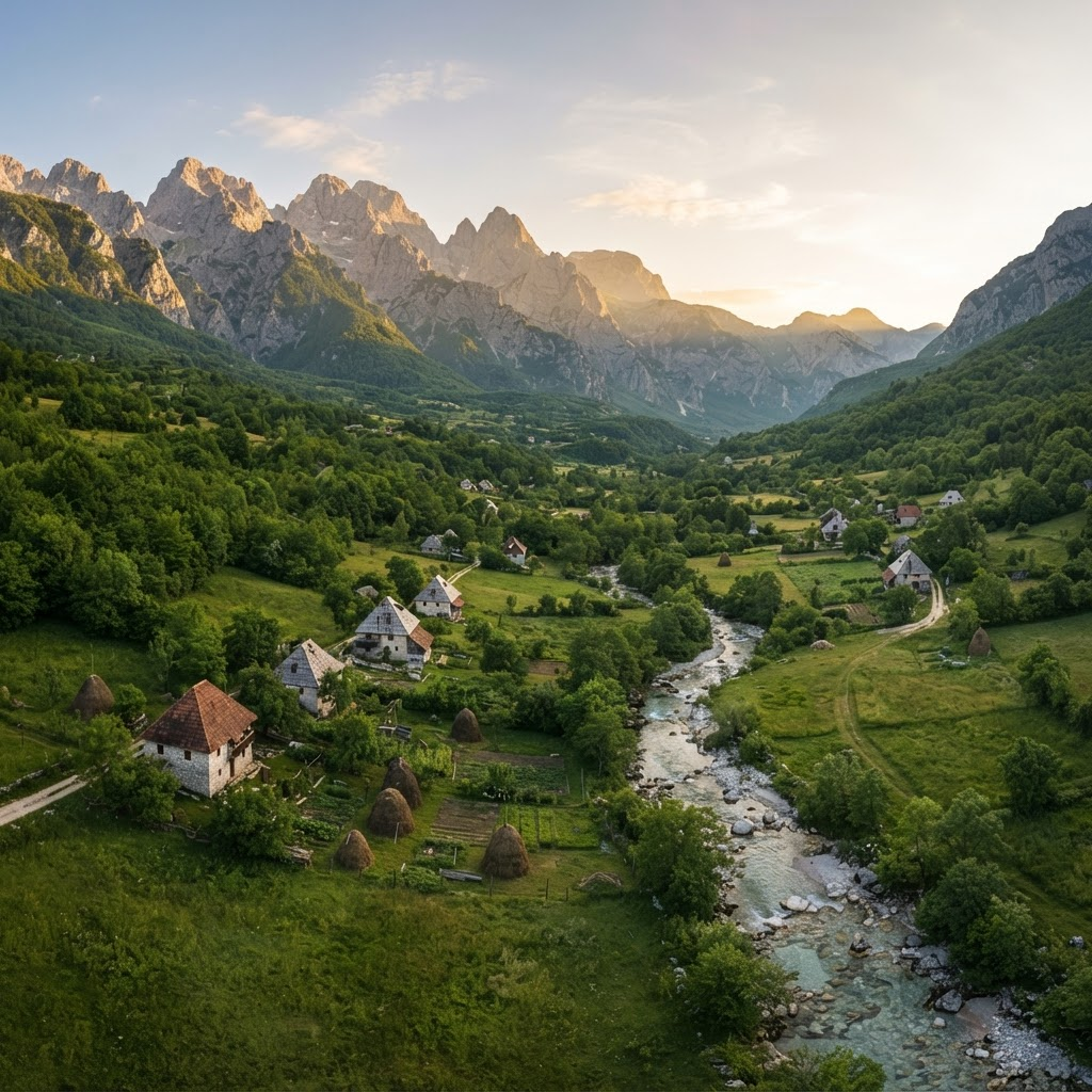
Theth National Park visitor guide logo
Peaks of the Balkans
All hiking routes

Hiking route

Peaks of the Balkans

A cross-border journey through Albania, Kosovo and Montenegro

Trail at a glance

Distance

≈192 km full loop

Duration

7–10 days

Difficulty

Challenging, multi-day

Best season

Late June–September

Peaks of the Balkans

The Peaks of the Balkans is a high-mountain circuit linking remote valleys in three countries. The route was designed around family-run guesthouses, border villages and historic paths rather than a continuous wilderness corridor, so hikers should expect a mix of alpine trail, pasture and connecting road.

Theth, Plav or another gateway village

What makes it special

The high country between Plav, Vusanje and Theth

Dobërdol, glacial lakes and border ridges

Hospitality in remote mountain villages

Planning the route

  • —The full circuit is about 192 km, but stage distances vary by chosen variants, transfers and overnight stops.
  • —Starting in Theth is practical from Tirana; starting near Cerem or Plav can place quieter terrain earlier in the itinerary.
  • —The Theth–Valbona stage is the busiest part of the circuit. An early start improves both heat management and trail experience.

Safety and conditions

  • Cross-border permits are required for designated mountain crossings. Arrange them well in advance and carry copies.
  • Late-summer springs can weaken or dry out. Confirm water sources each morning and carry a filter plus reserve capacity.
  • Unofficial variants may be unmarked and more serious than the classic route; use current mapping and local guidance.

Practical trail guide

Planning the full journey

Choosing a direction and itinerary

A seven-day itinerary samples the circuit, while eight to ten days gives more room for the standard stages, weather delays and side trips. The scenery is not uniform: many hikers find the Plav–Vusanje–Theth side especially dramatic, while Theth–Valbona delivers a classic pass crossing with substantially more traffic.

The circuit can be walked in either direction. The best choice depends on transport, accommodation availability and whether the hiker prefers the busiest stage near the beginning or end. Road transfers are sometimes used around Plav and other valley approaches, but they should be arranged locally rather than assumed.

Food, fuel and resupply

The trail is built around guesthouses, where dinner, breakfast and a packed lunch are commonly available when booked. Independent campers need a more conservative plan: Theth has only basic supplies, many villages have no real shop, and Plav is the principal supermarket resupply point.

Screw-thread gas canisters can be difficult to source across the route. Hikers cooking independently should confirm availability before travel and never rely on finding a compatible canister in a trail village.

Cash, transport and luggage

Cash remains essential in mountain villages. Albania uses lek, while Kosovo and Montenegro use euros; many Albanian guesthouses also accept euros, but this should be confirmed rather than assumed. Cards are most useful in Tirana and Plav. ATM operator fees and exchange rates vary widely, so hikers should compare the amount shown before confirming, carry smaller notes and withdraw a generous reserve before the trail.

Most visitors enter through Tirana and travel via ShkodĂ«r to Theth; Podgorica is a practical alternative for starting near Plav. Shared Tirana–Theth transport commonly takes around five to six hours, while a private transfer can be faster but substantially more expensive. Schedules and prices change, so travellers should reconfirm them and leave generous flight buffers. ShkodĂ«r and Tirana accommodation or luggage services may store non-hiking bags when arranged in advance.

Camping and water

Wild camping should not be treated as automatically permitted. Protected-area rules differ across the three countries; designated sites or a guesthouse garden with permission are the safer choice. Every camp should follow Leave No Trace principles and avoid livestock areas and water sources.

Water is often available from springs, streams and guesthouses, but this is seasonal rather than guaranteed. By late August, minor sources and some lakes may be low or dry. A filter or treatment system remains advisable, especially below grazing land.

Crowds, roads and route variants

The Peaks of the Balkans is increasingly popular. It is not uniformly crowded, but groups concentrate around famous stages, especially Theth–Valbona and prominent viewpoints. Early departures and less common overnight stops can make the experience quieter.

The official trail connects living villages, so road and forest-track sections are part of its character. Parallel alpine variants can be more scenic but may add navigation, exposure and rescue complexity. They are appropriate only when verified with current maps, weather and local expertise.

Side trips worth planning for

The marked circuit is only one way to experience the region. Extra days create room for several outstanding side trips, but these should be treated as separate mountain objectives rather than casual additions to an already long stage.

  • —Blue Eye of Theth: a spring-fed pool near Nderlysaj, roughly 17–18 km return when walked from central Theth, or a much shorter hike from the road-accessible trailhead.
  • —Valbona–Cerem high route and Zla Kolata: a strenuous alpine alternative. The summit extension reaches 2,534 m and may involve exposed scrambling and lingering snow; it is for experienced hikers in stable conditions, preferably with local guidance.
  • —Grebaje Valley and Lake Plav: a strong rest-day combination from Plav. Grebaje is reached by a road transfer and offers dramatic walking beneath the Karanfili walls; transport should be arranged locally.
  • —Buni i Jezerces, the Valley of Six Lakes: a remote high-alpine option from the Vusanje side. It adds distance and navigational commitment to the return toward Theth; jeep access may shorten the approach when locally available.
  • —Gjeravica: Kosovo’s 2,656 m high point can be added as a demanding day hike, commonly from the DobĂ«rdol area. Route choice, border permissions and conditions should be confirmed in advance.

A flexible sample itinerary

A route with rest days and high-alpine additions can take ten to twelve walking and sightseeing days. The outline below is an example, not a fixed prescription: distances and ascent depend on the exact GPS line, accommodation and variants selected.

  • —Arrive in Theth via ShkodĂ«r; use an extra day for the Blue Eye or a shorter valley walk.
  • —Theth–Valbona: approximately 16–18 km with about 1,000–1,130 m of ascent.
  • —Valbona–Cerem: follow the official lower connection or undertake the much harder high-pass variant; Zla Kolata makes this an exceptionally long day.
  • —Continue Cerem–DobĂ«rdol, optionally add a separate Gjeravica day, then walk through Milishevc toward Babino Polje and Plav.
  • —Use Plav for rest or Grebaje Valley, then continue Plav–Vusanje and return to Theth. The Buni i Jezerces variant requires additional time and stronger navigation.
  • —Some itineraries omit road-heavy stages such as the full Milishevc–RekĂ« e AllagĂ«s–KuçishtĂ« connection. Any shortcut must preserve legal border crossings, confirmed transport and booked accommodation.

Guesthouses, booking and daily payment

Guesthouses are the backbone of the trail. Many list on major booking platforms, while smaller properties may take reservations through WhatsApp, Facebook or direct phone contact. A reservation shown online may still be payable in cash on departure.

Hosts commonly total the bed, dinner, breakfast, packed lunch and drinks in the morning. Hikers should confirm the currency and price when booking, keep a written tally and carry a reserve rather than assuming an ATM or card terminal will be available. Peak-season flexibility is decreasing, so popular stops should be reserved well ahead.

Hospitality is generally warm and the route is widely regarded as safe, but normal travel precautions still apply: secure cash and documents, share the itinerary, and do not present the absence of past incidents as a guarantee.

Packing for a summer circuit

A lighter pack makes the repeated climbs substantially easier. Summer valleys can be very hot, while high passes can still turn cold, wet and windy within minutes. Clothing should therefore be minimal but layered, and summit variants require a larger safety margin than the standard guesthouse route.

  • —Two or three quick-drying hiking sets, warm mid-layer, waterproof shell and sun-protective hat.
  • —Broken-in trail shoes or boots, wool or synthetic socks, blister care and optional trekking poles.
  • —Offline map, charged phone, power bank, headlamp, compact first-aid kit and emergency insulation.
  • —Water treatment and enough capacity for dry late-summer stretches; food can usually be purchased through guesthouses, but an emergency snack reserve is prudent.

Common planning questions

Experienced long-distance hikers can complete the standard circuit self-guided with permits, current offline mapping and careful bookings. A licensed guide adds real value for exposed summit variants, uncertain snow, limited navigation experience or travellers who prefer logistical support.

  • —Direction: both directions work. Counter-clockwise is common and can create repeated encounters with the same hikers; accommodation and side-trip plans matter more than convention.
  • —Fitness: hikers should be comfortable with consecutive six-to-eight-hour mountain days and roughly 1,000 m of ascent while carrying their planned pack. Summit variants demand more.
  • —Water: springs and guesthouse taps are common, but treatment is advisable and seasonal availability must be checked daily.
  • —Language: Albanian is used in Albania and widely in Kosovo; Serbian is also official in Kosovo, while Montenegrin is used in Montenegro. English varies, and offline translation is useful.
  • —Food: guesthouse meals often feature local vegetables, cheese, soup, bread, fish or meat. Dietary requirements should be communicated before arrival.

Before setting out

01

Apply for all required cross-border permits several weeks ahead.

02

Book guesthouses and confirm meals, camping or luggage storage directly.

03

Download offline maps and carry a backup power source.

04

Plan cash, food and compatible stove fuel before entering the mountains.

05

Ask each host about the next stage’s water, weather and trail condition.

Distances, times, access, and trail conditions are indicative and can change. Verify locally before setting out; use a licensed guide for remote routes.